Where creativity meets strategy to transform your social media presence. We are a passionate team of digital enthusiasts, designers, and marketers who are dedicated to helping businesses thrive in the ever-evolving world of social media.
Who We Are
Coastal & River Hydraulic Consultancy
Advanced Hydraulic Modelling for Coastal, Marine & River Environments
Aqvaspace Sdn Bhd provides specialised coastal and river hydraulic modelling services to evaluate complex water dynamics and support sustainable engineering solutions.
Using industry-leading DHI MIKE software, we conduct detailed numerical simulations of river flows, tidal currents, wave propagation, sediment transport and coastal processes. Our modelling capabilities enable us to assess potential environmental impacts, predict hydraulic behaviour and evaluate engineering interventions under various scenarios.
From flood and inundation assessments to coastal structure analysis, dredging optimisation and land reclamation studies, we deliver science-based insights to support engineering design, environmental assessments and regulatory approval.
Our approach combines historical environmental data, advanced modelling techniques and technical expertise to help clients make informed decisions and develop resilient water infrastructure.
Integrating land-use mapping with slope and elevation analysis to establish a high-fidelity foundation for sustainable land management and agricultural suitability
Extreme Scenario Analysis
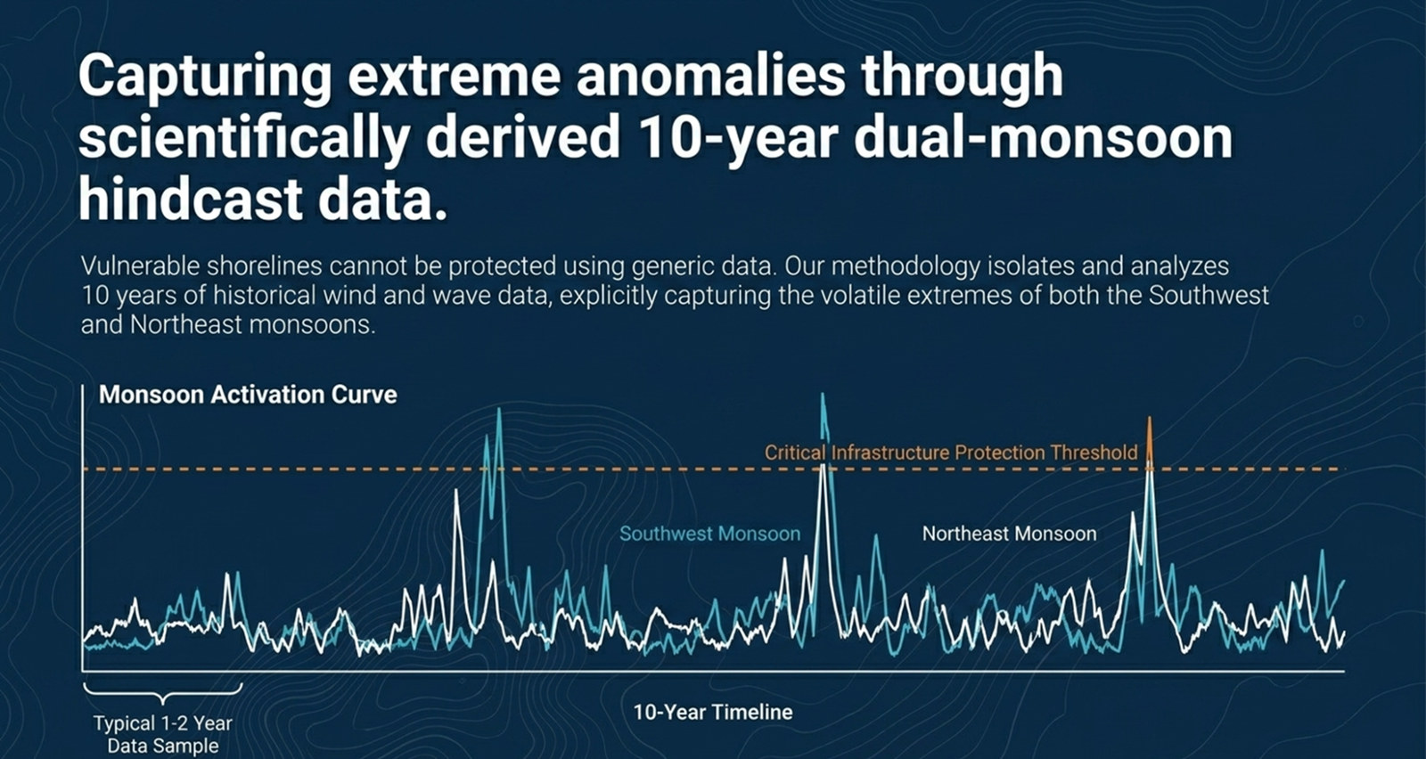
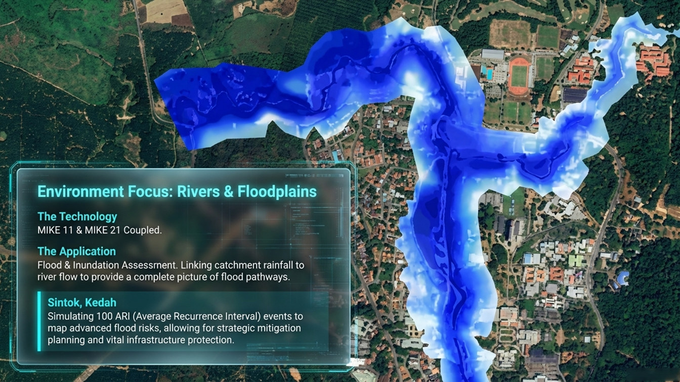
Using 10-year monsoon data to simulate worst-case 100-year ARI events and establish critical infrastructure safety thresholds.
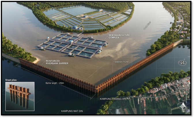
Sand Dredging & Capital Works
Simulating plume dispersion and sedimentation patterns to optimise dredging and ensure environmental compliance.
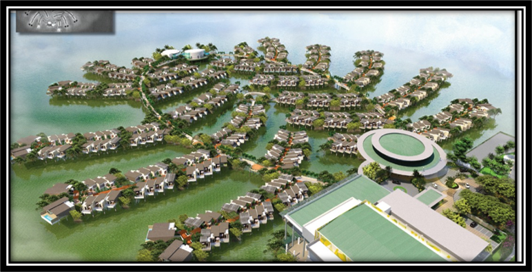
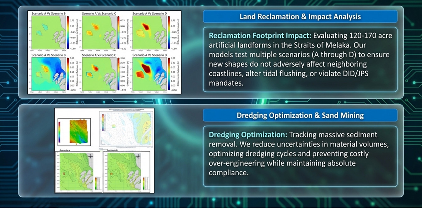
Land Reclamation & Artificial Islands
Evaluating reclamation footprints and their effects on local hydrodynamics, neighbouring coastlines and tidal flushing.
Coastal Structures & Port Infrastructure
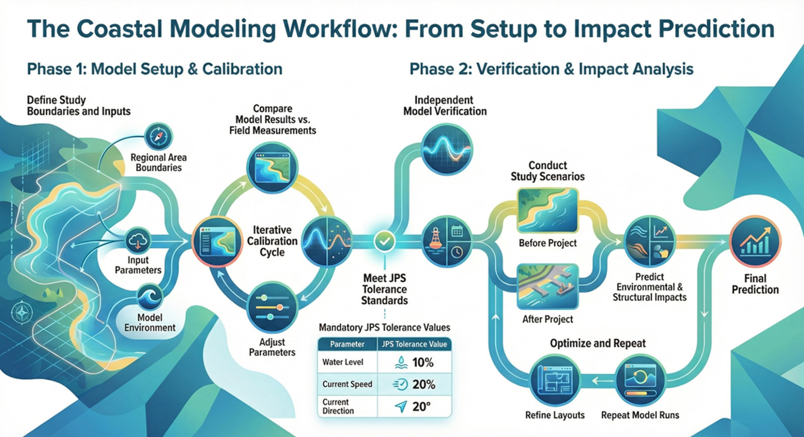
Conducting before-and-after impact studies for jetties, breakwaters and revetments to optimise coastal protection designs.
Flood Mitigation
Designing strategic river improvements and drainage solutions to protect critical infrastructure and surrounding communities.
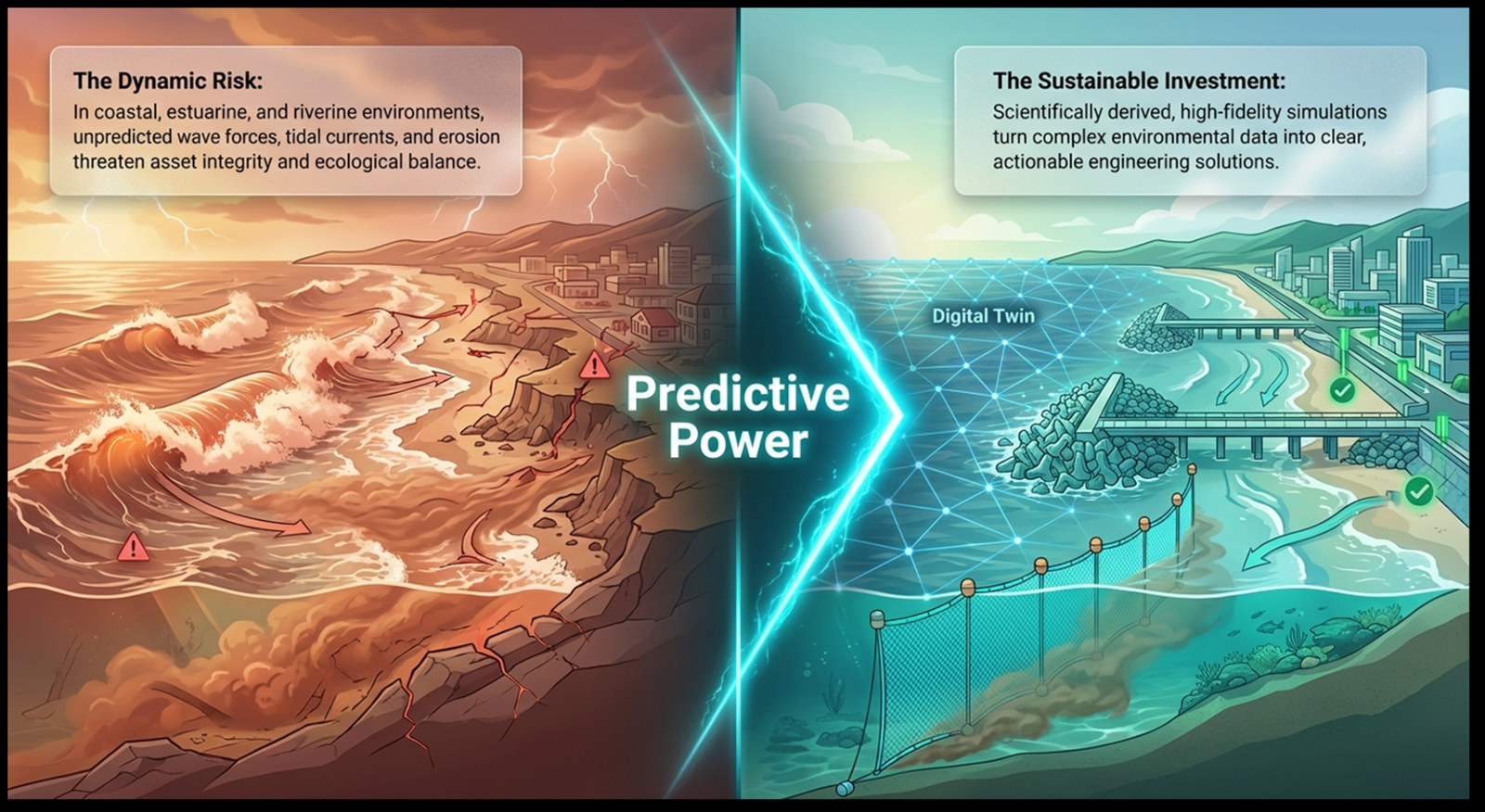
Predictive Power: The Digital Twin Approach to Coastal Resilience
While environmental forces threaten asset integrity, Aqvaspace provides the predictive power to turn complex data into sustainable, clear, and actionable engineering solutions.
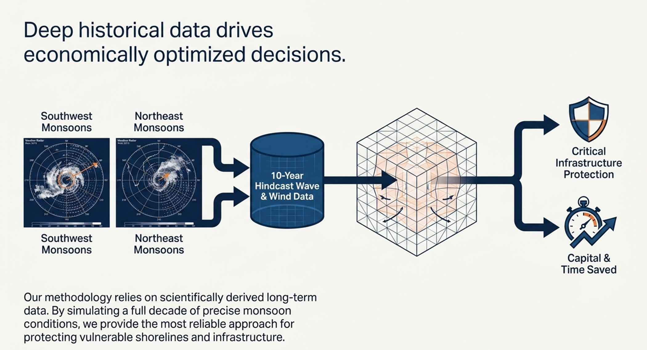
Engineering Against Extremes: 10-Year MetOcean Hindcasting
Precision Wave & Wind Data for Resilient Infrastructure
Capturing the Extremes
Understanding Extreme Monsoon Conditions Through Historical Data
Beyond the Horizon: Precision MetOcean Data & Hindcasting
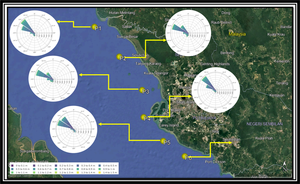
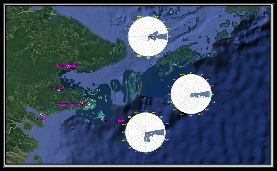
Aqvaspace delivers comprehensive MetOcean studies leveraging 10-year hindcast data and wind/wave roses. Our data-driven approach provides a precise historical profile of oceanographic conditions, enabling smarter engineering decisions and cost-effective coastal protection. We translate complex environmental variables into the scientific certainty required for resilient, sustainable infrastructure design.
Application
Continuing our commitment to engineering excellence, our specialized Hydraulic Modelling services provide high-fidelity analysis across the entire water cycle. Utilizing the MIKE 21, 21C, and 11 suites, we deliver “decision-ready” insights into complex hydrodynamic processes, including tidal currents, wave transformations, and sediment transport dynamics. This rigorous numerical approach allows us to predict morphological changes and flood propagation with absolute precision, ensuring that all interventions meet the stringent standards of DOE and JPS approval while optimizing your project’s economic and environmental performance.
Shaping the Coast: How Structures Influence Coastal Currents
Aqvaspace leverage MIKE 21 Flow Model FM and its high-resolution flexible mesh approach to simulate complex hydrodynamic environments. By incorporating 10-year hindcast data, we provide specialized analysis of monsoon-driven flow velocities and current patterns. This enables us to precisely predict the impact of coastal structures on local hydraulics, ensuring critical infrastructure is engineered for maximum resilience and stability.
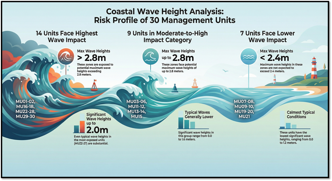
Understanding Coastal Wave Conditions
Tracking Pollution / Sediment in Coastal Waters
Aqvaspace delivers high-resolution plume dispersion and hydraulic modelling using the MIKE 21 suite. We visualize the transport of sediment, thermal discharge, and emissions in complex marine environments. By accounting for tides and wind, our simulations ensure the scientific certainty required for regulatory approval.
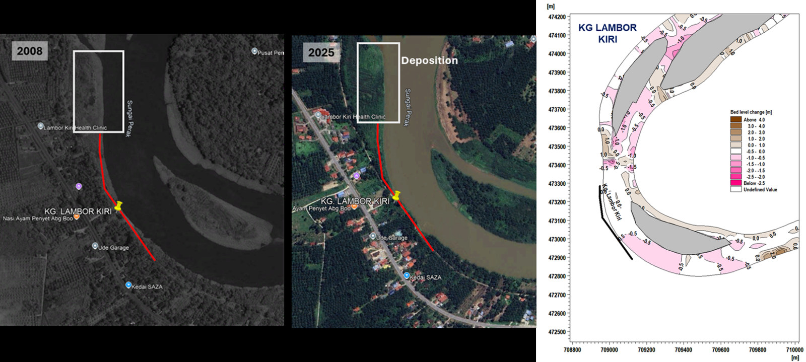
Dynamic Morphological Modeling: Predicting Long-Term River & Coastline Evolution
Aqvaspace delivers high-resolution plume dispersion and hydraulic modelling via the MIKE 21 suite. We visualize the movement of sediment, thermal discharge, and emissions in complex marine environments. By accounting for tidal currents and wind patterns, our simulations ensure DOE compliance and provide the scientific certainty required for regulatory approval.
Flood & Inundation Assessment
Mapping Flood Risks Through Integrated Catchment-to-River Modelling
Land Reclamation & Dredging Impact Analysis
Evaluating Environmental Impacts and Optimising Marine Developments